Let Baragar’s experts build you an easy-to-use geographic information system designed to aid in capital resource management and educational problem-solving. Designed for planners as well as educators and administrators, it requires neither technical expertise nor GIS experience.
GeoSchool


Features of our customized, turnkey system and services include:
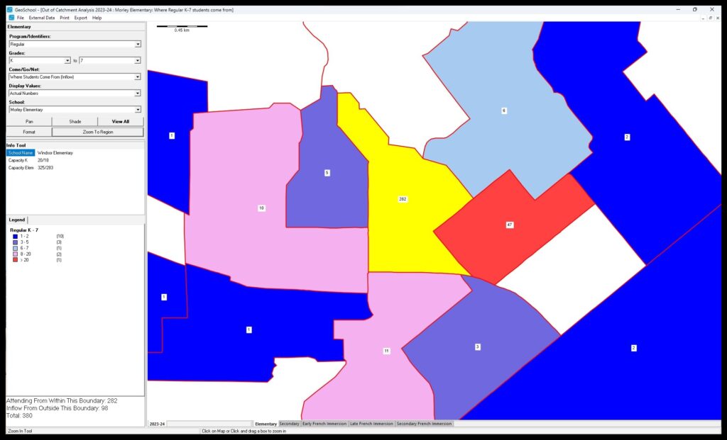
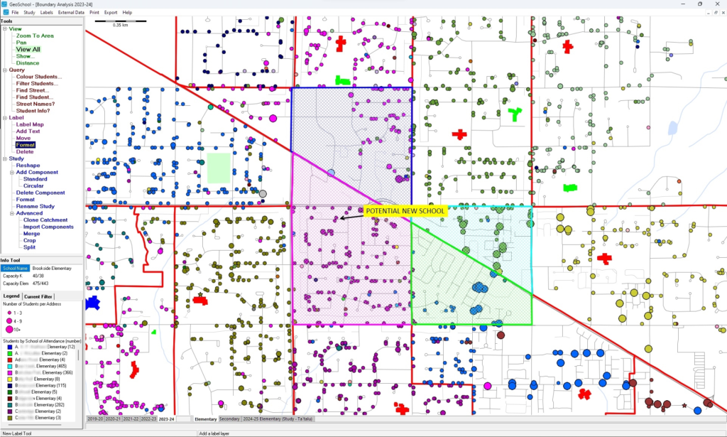
- Analyze the impact of boundary changes, school closures and openings, grade reorganization, program relocation and changes to the organizational structure.
- Instantly measure the extent of ‘cross-boundary’ registration and present the results geographically.
- Multiple years of geographic student data allows for sophisticated trend analysis.
Powerful yet simplified analysis
- Immediate dynamic changes to the visual displays, depicting ‘what if’ scenarios, and presentation-ready maps create credibility and transparency in public consultations.
- Presentation-ready reports – including lists of affected students, the impact on each school by program and grade, and detailed information about out-of-catchment students.
Why Baragar?
Personalized ongoing support
Our service doesn’t end once your annual software update is delivered. Need help or advice? We’re here for you.
Leverage accurate data
All good strategy begins with good data! Curating data from external sources is complicated and time-consuming – we do it all for you.
Experienced Staff
Team leads average 20+ years of experience at Baragar, with additional staff averaging 10+ years.
Move beyond reactive planning
Baragar’s software, data, and services highlight potential problems well in advance. Taking proactive action allows you to minimize the impact on students and families.